File:Map of Alaska highlighting Northwest Arctic Borough.svg

Size of this PNG preview of this SVG file: 800 × 423 pixels. Other resolutions: 320 × 169 pixels | 640 × 338 pixels | 1,024 × 541 pixels | 1,280 × 677 pixels | 2,560 × 1,353 pixels | 1,470 × 777 pixels.
Original file (SVG file, nominally 1,470 × 777 pixels, file size: 338 KB)
Summary
| Description |
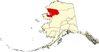
English: This is a locator map showing Northwest Arctic Borough in Alaska |
| Date | |
| Source |
Own work: English: The maps use data from nationalatlas.gov, specifically countyp020.tar.gz on the Raw Data Download page. The maps also use state outline data from statesp020.tar.gz. The Florida maps use hydrogm020.tar.gz to display Lake Okeechobee. |
| Author | David Benbennick |
Licensing
| I, the copyright holder of this work, release this work into the public domain. This applies worldwide. In some countries this may not be legally possible; if so: I grant anyone the right to use this work for any purpose, without any conditions, unless such conditions are required by law. |
File history
Click on a date/time to view the file as it appeared at that time.
| Date/Time | Thumbnail | Dimensions | User | Comment | |
|---|---|---|---|---|---|
| current | 19:28, 5 Paniqsiivik 2006 | | 1,470 × 777 (338 KB) | David Benbennick | {{subst:User:Dbenbenn/clm|county=Northwest Arctic Borough|state=Alaska|type=borough and census area}} |
File usage
The following page uses this file:
Global file usage
The following other wikis use this file:
- Usage on az.wikipedia.org
- Usage on bpy.wikipedia.org
- Usage on ca.wikipedia.org
- Usage on ceb.wikipedia.org
- Usage on ce.wikipedia.org
- Usage on cy.wikipedia.org
- Usage on de.wikipedia.org
- Usage on en.wikipedia.org
- List of boroughs and census areas in Alaska
- Northwest Arctic Borough, Alaska
- Ambler, Alaska
- Buckland, Alaska
- Deering, Alaska
- Kiana, Alaska
- Kivalina, Alaska
- Kobuk, Alaska
- Kotzebue, Alaska
- Noatak, Alaska
- Noorvik, Alaska
- Red Dog Mine, Alaska
- Selawik, Alaska
- Shungnak, Alaska
- Iñupiat
- Kiwalik, Alaska
- Kotzebue Sound
- Selawik River
- Baldwin Peninsula
- Cape Krusenstern
- Kivalina River
- Hogatza River
- Selawik Lake
- Wikipedia:WikiProject Alaska
- Chamisso Wilderness
- Buckland River
- Nigu River
- Squirrel River
View more global usage of this file.