File:Front view of Rhode Island State House.jpg

Size of this preview: 800 × 499 pixels. Other resolutions: 320 × 200 pixels | 640 × 400 pixels | 1,024 × 639 pixels | 1,280 × 799 pixels | 2,560 × 1,598 pixels | 3,703 × 2,312 pixels.
Original file (3,703 × 2,312 pixels, file size: 2.42 MB, MIME type: image/jpeg)
Summary
| Description |
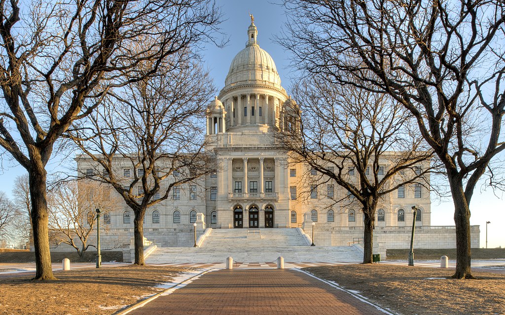
English: The Rhode Island State House is composed of 327,000 cubic feet of white Georgia marble, 15 million bricks, and 1,188 tons of iron floor beams.
The dome of the State House is the fourth-largest self-supporting marble dome in the world, after St. Peter's Basilica, the Minnesota State Capitol, and the Taj Mahal. On top of the dome is a gold-covered bronze statue of the Independent Man, originally named "Hope".
|
||
| Date | 3/14/14 | ||
| Source | Own work | ||
| Author | Bestbudbrian |
| Camera location | | View this and other nearby images on: OpenStreetMap |
|---|
Licensing
I, the copyright holder of this work, hereby publish it under the following license:
This file is licensed under the Creative Commons Attribution-Share Alike 3.0 Unported license.
- You are free:
- to share – to copy, distribute and transmit the work
- to remix – to adapt the work
- Under the following conditions:
- attribution – You must give appropriate credit, provide a link to the license, and indicate if changes were made. You may do so in any reasonable manner, but not in any way that suggests the licensor endorses you or your use.
- share alike – If you remix, transform, or build upon the material, you must distribute your contributions under the same or compatible license as the original.

|
This image was uploaded as part of Wikipedia Summer of Monuments.
|
 |
File history
Click on a date/time to view the file as it appeared at that time.
| Date/Time | Thumbnail | Dimensions | User | Comment | |
|---|---|---|---|---|---|
| current | 17:20, 18 Niġlaalgit Tiŋŋiviat 2014 | | 3,703 × 2,312 (2.42 MB) | Bestbudbrian | User created page with UploadWizard |
File usage
The following page uses this file:
Global file usage
The following other wikis use this file:
- Usage on ang.wikipedia.org
- Usage on bcl.wikipedia.org
- Usage on bn.wikipedia.org
- Usage on co.wikipedia.org
- Usage on cy.wikipedia.org
- Usage on da.wikipedia.org
- Usage on en.wikipedia.org
- Usage on et.wikipedia.org
- Usage on eu.wikipedia.org
- Usage on fr.wikipedia.org
- Usage on hif.wikipedia.org
- Usage on id.wikipedia.org
- Usage on io.wikipedia.org
- Usage on lad.wikipedia.org
- Usage on la.wikipedia.org
- Usage on ro.wikipedia.org
- Usage on sc.wikipedia.org
- Usage on sk.wikipedia.org
- Usage on sr.wikipedia.org
- Usage on th.wikipedia.org
- Usage on uz.wikipedia.org
- Usage on vi.wikipedia.org